Sudoku Puzzle Solver
Python code to solve Sudoku Puzzles through use of a source CSV file
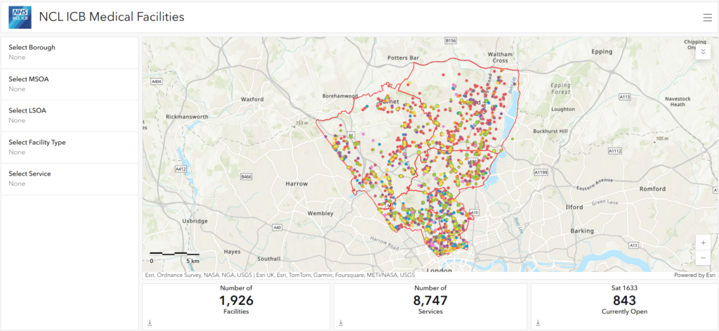
Create Medical Services Shapefile
Combined all the required datasets into a single pandas dataframe (Clinics, Dentists, GPs, Hospitals, Opticians, Pharmacies).
Processed data and created zipped shapefile.
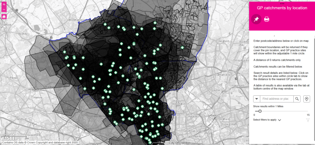
Created NCL ICB Medical Locations using Web Address: https://api.nhs.uk/service-search/search
This Python script allows users to create all Medical Facilities within NCL ICB and export them as Web Map Services.
QoF CSV Ingestion File
This Python script allows users to import Quality and Outcomes Framework (QoF) data from PHE FingerTips (Open Source Data) and publish it as a Web Map Service.
Import GP Population Data with Coverage and Percentages
This Python script allows users to import GP population data, create 75% population and PCN coverage diagrams, and exports data to WMS format.

This app shows the locations GP Practices and their QoF measures from 2015/16 for the QoF Intervention Rates, QoF PCA Rates, QoF Prevalence Rates and QoF Underlying Rates.

The Cancer Services profile tool contains data at general practitioner (GP) practice, primary care network (PCN), sub-integrated care board (sub-ICB), integrated care board (ICB) and at a national level.

This app shows the locations of pharmacies within a desired distance from a chosen location. Users can also filter these locations and then export them as a CSV, JPEG or PDF.

GP catchments by location. Catchment boundaries will be returned if they cover the pin location, and GP practice sites will show within the adjustable 1 mile circle.

This app shows the census data relating to the ethnicity and English language skills of the local population.

This app shows the locations of medical facilities and services within North Central London within a desired distance from a chosen location. Users are also able to filter these locations.
